As we steadily progress into a digital world, more and more apps are being developed to cover the needs of basically everything. The sailing world offers no exception. Navigating the seas and its dangers once required sophisticated skills, complicated technologies, and expensive instruments. It also meant carrying a bulky set of maps. Nowadays, a smartphone or tablet and a few apps can get you pretty far. The abundance of available apps makes it challenging to keep track of their capabilities. In this post, we’ll explore the top navigation apps compatible with SailProof tablets, helping you navigate the sea of options effortlessly.
Before you feel overwhelmed, it’s worth noting that most apps offer lengthy trial periods to test their features comprehensively. Furthermore, when purchasing a SailProof we have secured you some great offers through our partners, check it out here!
Lastly, keep in mind that not all apps can be compared directly, they differ in chart formats, coverage areas, capabilities, and prices. Aligning your needs with the app’s capabilities is not easy but will save you money and time in the long run.
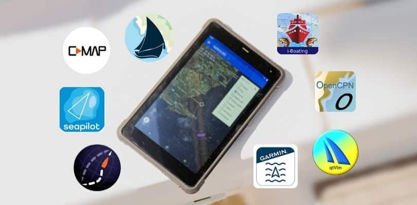
Now, let’s dive into the world of digital charts and app-based navigation. Below, you’ll find a curated list of top navigation apps available on the Google Play Store:
Navionics
Let’s start with Navionics, perhaps the best-known navigation app among sailors. Navionics is widely recognized among sailors for its user-friendly interface and high-quality charts. It offers useful community information on anchor spots and marinas, along with route-sharing options and compatibility with AIS transceivers.
Navionics also offers sonar chart overlays and community depth information, allowing users to access detailed underwater topography shared by other sailors. The app is overall easy and intuitive to use, offering auto-routing options and basic weather information. One notable feature is the access to tide buoys and information, allowing users to simulate expected depths on the map. While this feature can be very useful, it should also be used with care to ensure accurate navigation.
Trial Period: Offers a 14-day trial period for users to explore features before committing.
Costs/Subscriptions: Yearly subscription basis with the option to use charts beyond the end of the subscription period. However, updates and most extra functions will cease to function without an active subscription.

Aqua Map – Mobile Chartplotter
An app with a simple, fast, and clear interface. The AIS overlay is very good and offers collision alerts, and easy access to all AIS Targets and their names/MMSI’s in a list format. Furthermore, Aqua Map includes a powerful anchor alarm and provides access to marine forecast weather (wind, waves, currents). Lastly, the ‘Route Explorer’ feature allows for navigation with real-time information on bridges, hazards, and info on best fuel prices. If you’re interested in the social attributes of the app has live sharing functions in the Aqua Map community, and access to Active Captain and Waterway Guide community.
The App has become very popular among sailors from the US with lots of features, especially for US waters (More than 90000 USA Army Corps of Engineers surveys updated weekly, US Coast Guard light list and local notice to mariners(LNM), Weekly NOAA charts updates, Tides and Currents stations info, Mile Marker, Estuarine Currents)
Trial period: 14-day trial available.
SailProof offer: Aqua Map offers a 30% discount when you buy an Android SailProof tablet.
Costs/Subscriptions: offers all kinds of maps on a yearly subscription basis with frequent updates (Free Maps available for certain areas). The App offers various NMEA instrument integrations such as (depth sounder, wind sensor, compass, GPS, and AIS) on a small additional yearly fee. Another interesting feature is the ability to choose from maps available in smaller coverage areas and therefore often being offered at lower prices.

C-map
C-Map offers a comprehensive free version that provides access to all charts and numerous functions when online. While precise positioning and advanced navigation functions are excluded, the app includes autorouting, weather information, and internet-based AIS data. Users can benefit from a 14-day trial to explore premium features.
In addition to its core functionalities, C-Map also offers unique features that enhance user experience:
- Social Map: Users can interact with a community of boaters and sailors through the Social Map feature, sharing insights, tips, and experiences.
- Private User Area: The app includes a private area where users can manage their own waypoints, routes, and personal settings, offering a customized navigation experience.
These features make C-Map a versatile tool for both casual and serious mariners, combining practical navigation tools with a supportive community and personalized options.
Trial Period: 14-day trial available.
Costs/Subscriptions: For offline maps and navigation a yearly subscription is needed, which then offers lots of features and global coverage. Although the yearly subscription fee can be high, it includes global coverage. Which makes it cheaper and easier to travel through multiple regions throughout the year.
NavimetriX
NavimetriX is the new app for 2026. From the creator of SailGrib, this app brings all the features you need to plan your sailing routes in one place. It lets you prepare routes before getting on the boat and start them once on board, making the transition between land and sea seamless. It is versatile and works on multiple platforms, so you can use it on the boat, at the office, or anywhere else.
It allows sailors to plan routes easily, view weather data from GRIB files, and calculate the best course using wind, waves, and currents. The routing features are especially useful, with options for multi-routing, AI-assisted weather briefings, and fine-tuning performance based on your boat’s polar data. Its intuitive interface makes managing trips, checking instruments, and simulating navigation simple.
Costs/Subscriptions: NavimetriX is available as a free version with basic navigation tools, while full features—including advanced routing, extended weather forecasts, and multi-platform syncing—can be unlocked through an in-app purchase.
SailProof offer: As our new partner, with the purchase of any SailProof device, you will receive a 3-month free trial.

INavX
From chats and forums, iNavX appears to be the main competitor to Navionics due to their similar focus and chart coverage. The main difference lies in user experience and simplicity, where Navionics is said to make life easier. iNavX can feel overwhelming at first, as its high level of customization makes the learning curve quite steep. However, once you get past the initial complexity, it becomes a powerful navigation app with a broad range of chart options, including Navionics, C-MAP, and NOAA.
Their partnership with Waterway Guides adds micro-level detail for marinas and facilities (though the UK version is still pending). All the information is there, but interrogating chart data isn’t as intuitive as in other apps, and building or adjusting routes can feel cumbersome. Although the manual is comprehensive and there are excellent YouTube tutorials available, ideally the interface should be easier to master directly within the app.
It includes a GRIB viewer, but tides and currents require syncing an additional app. The distance and bearing tools work very well, providing precise latitude and longitude for each point. AIS overlay is available for an extra fee, and the anchor-drag alarm is a valuable safety feature. iNavX can also function as a mobile repeater for your boat’s main navigation system.
Costs/Subscriptions: According to their latest social media updates, the app is now free to use, while charts and add-ons are available as paid optional upgrades. No subscription is required, which makes turning it on and off throughout the sailing season quite convenient.
OpenCPN
With OpenCPN you have two options, a free app that is not being updated anymore, but still works for most devices, and an app at a small cost (~10€) that is updated and more reliable. Both versions come with lots of very useful functions, admittedly they are not super easy to use and graphics are not spectacular but with some patience and research, you will get there. Additionally, the App offers a large variety of functions such as AIS/NMEA integration, alarms, etc., while lots of charts are totally free and the ones for purchase are arguably very fair priced. But as mentioned it requires some skills and research to figure everything out.
Costs/Subscriptions: Free or one-time purchase of the app, no free trial on the paid version. No subscription just the purchase of maps as needed.

i-Boating
The i-Boating App provides essential features for navigation, including weather information, a straightforward auto-routing function, NMEA integration, and the capability to send and receive NMEA information and commands (even without an active subscription). Moreover, users can configure the app to send route information to their autopilot via NMEA connections.
Costs/Subscriptions: The App is free but charts for offline use must be purchased and are reasonably priced. Unfortunately, no trial is available.
Seapilot
It is a very simple-looking app with features based on professional ECDIS charting systems. It is available for free or on a yearly subscription basis. Note that for both options, maps need to be purchased additionally, although some regions offer free maps. Seapilot App has potential, with options for weather routing and boat-specific polar. However, its development seems to be abandoned, and the latest news from their website dates back to 2020.
Costs/Subscriptions: This could be a low-to-free option for some areas and when limited features are required.
qtVlm
Sailors using qtVlm find it an incredibly versatile tool for navigation and weather routing. It allows them to plan routes, visualize GRIB weather files, and view charts in multiple formats, from vector and raster to Visit My Harbour. The AIS and instrument integration make it easy to track boats and monitor performance, while the qtVlm Companion app keeps all data connected on mobile devices and smartwatches. Users particularly appreciate the multi-routing and simulation modes, which let them test different scenarios, and the ability to load multiple GRIB files at once for comparing forecasts.
Costs/Subscriptions: qtVlm is free for Windows, MacOS, Linux, and Raspberry, with a basic free version for Android, iOS, and Windows tablets, unlockable to full features via in-app purchase.
SailProof offer: Buy a Sailproof tablet and enjoy the full version of qtVlm for free and for life on this device.

Navigating the seas has never been easier thanks to the wide range of apps available for SailProof tablets. From well-known favorites like Navionics and Aqua Map to newcomers like NavimetriX, each app offers unique features that cater to different sailing styles, needs, and levels of experience.
In this new era, as paper charts stop being updated, it’s important to find the app you feel most confident with—one that can truly make a difference in your sailing skills and confidence. In the end, combining traditional skills with these digital tools allows every sailor to navigate more confidently, enjoy the journey, and stay connected with the broader sailing community.