Chartplotters: The Evolution
Before the advent of chartplotters and digital navigation, mariners relied on a combination of paper charts, compasses, sextants, and dead reckoning to plot their courses. These traditional methods, while effective and time-tested, required extensive knowledge, skill, and continuous monitoring. Navigating through complex waterways, avoiding hazards, and accounting for tides and currents were labor-intensive tasks, often complicated further by poor weather, low visibility, or equipment limitations.
Despite the precision and reliability of digital navigation tools, many sailors continue to embrace the tradition and art of paper charts, valuing their simplicity, independence from power sources, and resistance to technical failures. However, obtaining printed charts has become increasingly difficult, as many publishers are gradually discontinuing their production. One of the most notable recent announcements came from IMRAY, a well-respected and beloved chart publisher, confirming that they will cease publishing paper charts after the 2025 season.
While many mariners transitioned to chartplotters, tablets, and digital navigation years ago, a significant number still hold on to paper charts, recognizing them as a dependable backup in case of electronic failure. Their ability to provide a clear, unchanging reference without reliance on batteries, GPS signals, or software updates makes them invaluable in certain situations. However, it is increasingly evident that the majority of paper charts will soon be replaced as the industry shifts towards fully digital solutions. This transition marks the end of an era in traditional navigation, yet it also highlights the growing accessibility and efficiency of modern charting technologies.
Chartplotters: the Digital Navigation Revolution
It all started in the 1970s–1980s, mostly due to the development of the Global Positioning System (GPS) in the 1970s and its civilian availability in the 1980s, which revolutionized navigation, allowing sailors to determine their precise position using satellites, reducing reliance on manual calculations. The digitization of paper charts was quickly adopted by the Canadian Hydrographic Service (CHS) and NOAA, creating government-backed digital charts, particularly for ENCs. In the commercial realm, Navionics and C-Map were among the first companies to offer digital charts tailored for recreational use. GPS and digital charts inevitably led to the first Chartplotters, which were rudimentary devices that displayed a vessel’s GPS position on a simple digital map. They lacked the detail of paper charts but were a major step forward in real-time navigation. These devices were expensive and primarily used by commercial vessels and well-funded recreational mariners.

1990s: Integration of Electronic Charts
The further Development of ENC and Raster Charts in the 90s led to the adoption of Electronic Navigational Charts (ENCs), and raster charts allowed digital chartplotters to display detailed, accurate charts similar to traditional paper charts. Companies like Garmin, Raymarine, and Furuno began producing advanced chartplotters tailored to the recreational boating market. This quickly led to Improved Interfaces and features such as waypoint plotting and route planning capabilities. Later, connectivity with external sensors (e.g., depth sounders, radars) became available.
2000s: Rapid Technological Advancements
Color Screens and Touch Controls: Chartplotters quickly adopted high-resolution color screens, improving chart clarity and readability. Touchscreen interfaces became popular, offering intuitive controls similar to smartphones. Modern chartplotters became central hubs for marine electronics, integrating with radar, AIS, sonar, and autopilot systems. Features like weather overlays, real-time traffic, and tide information became standard, most likely as an answer to the rising popularity of tablet/smartphone navigation apps.
2010s–2020s: Smart and Connected Navigation
The direct competition from tablet and smartphone navigation apps and their versatility let chartplotter manufactures to combine the capabilities of traditional chartplotters with tablet-like interfaces, allowing wireless connectivity to smartphones, tablets, and the cloud and allowing for remote route planning and updates. Chartplotters increasingly support third-party apps and services, offering more flexibility for users to customize their systems.
Today: Rugged marine Tablet Revolution
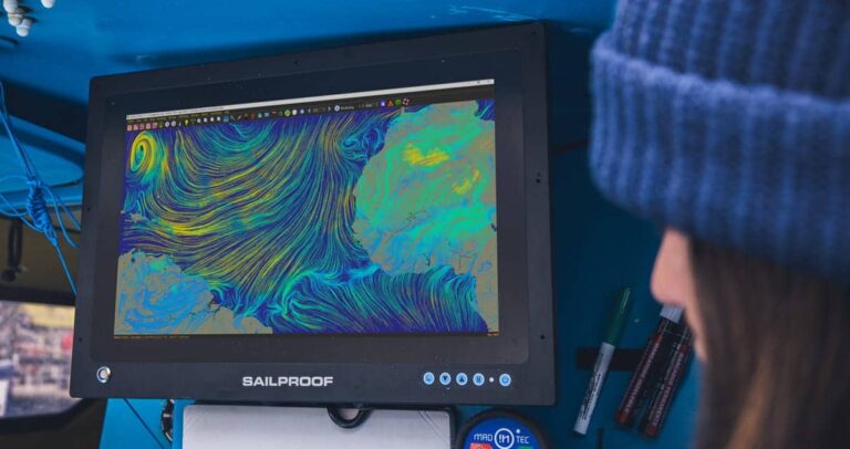
Although tablets and smartphones have been part of the digital chart evolution from the beginning, they were never specifically designed with sailors in mind. SailProof was the first tablet manufacturer to focus exclusively on this need, offering sailors a rugged and reliable device tailored to the marine environment. SailProof aims to provide an alternative or complementary solution to traditional chartplotters, which are often expensive, limited, and difficult to install. SailProof tablets ensure the same levels of reliability and robustness while adding versatility, portability, and affordability.
Today, many rugged tablets are available on the market; however, none are directly designed by sailors, for sailors like SailProof nor with the specific needs the sailing environment demands in mind, such as high and low temperatures, high screen brightness for sunlight readability, wet and glove touch, precise GPS, high battery capacity, etc. SailProof constantly incorporates feedback from sailors around the globe, from diverse backgrounds and disciplines, in order to further advance their products. SailProof tablets are mounted on Vendée Globe yachts, America’s Cup yachts, as well as rowing boats, cruising boats, and jet skis. But their reach doesn’t stop there. Their proven design and versatility have also earned them a place in research missions, expeditions, sea rescue organizations, firefighting teams, and more.

The Future
The marine industry appears to be moving away from a wired world, transitioning increasingly to wireless solutions. This shift simplifies the complexity of wiring numerous instruments aboard any ship and opens up significant opportunities for mobile devices like tablets. They now offer connectivity and data overlays that were traditionally exclusive to chartplotters, leveling the playing field.
While chartplotters will remain relevant, some are expected to adopt more tablet-like features, while others may revert to simplified, button-operated interfaces. Chartplotters will continue to play a critical role in new builds and commercial shipping, where vessel production/design is often centred around a centralized plotter.
However, it is anticipated that more and more second-hand and older boats will transition to plug-and-play solutions like tablets, especially as their original chartplotters become outdated. This trend will likely accelerate with the proliferation of WiFi/Bluetooth-enabled NMEA signal converters, allowing multiple devices to access boat data simultaneously from anywhere on board. The continued development of sailing-specific apps and devices, such as the SailProof tablet, is expected to lead the industry into new and exciting advancements.